Detail View: Maps: Louisiana and part of Arkansas
|
Filename:
|
m20181206-0016.jpg
|
|
Title:
|
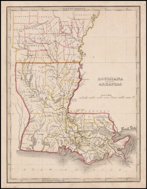
Louisiana and part of Arkansas
|
|
Coverage:
|
Louisiana
|
|
Coverage:
|
Arkansas
|
|
Creator:
|
Thomas Gamaliel Bradford
|
|
Date:
|
1835
|
|
Subject:
|
Regional map
|
|
Description:
|
Map of Louisiana and the southeastern part of Arkansas, from an early edition of Thomas Bradford's atlas.
Thomas Gamaliel Bradford (1802-1887) was an American geographic publisher. He hailed from Bradford, Massachusetts and began his publishing career by working for the America Encyclopedia. Then, he edited and republished the Atlas Designed to Illustrate the Abridgment of Universal Geography, Modern & Ancient, which had originally been offered in French by Adrian Balbi. In 1835, he published another atlas, A Comprehensive Atlas: Geographical, Historical & Commercial, and, in 1838, An Illustrated Atlas Geographical, Statistical and Historical of the United States and Adjacent Countries. His interests were primarily in educational publishing and he was one of the first mapmakers to show Texas as an independent country.
|
|
Format:
|
10 x 8 inches
|
|
Language:
|
English
|
|
Rights:
|
This image may be used without charge for non-commercial web sites under the condition that the sites or pages on which images appear contain a link back to the home page of the Noel Collection. The image may also be reproduced without charge in scholarly publications or in other printed material related to non-profit scholarly activities provided that such publications include a credit line acknowledging the Noel Collection as the source of the visual material. For all other purposes, please request permission to republish or redistribute images from the Noel Collection Curator.
|