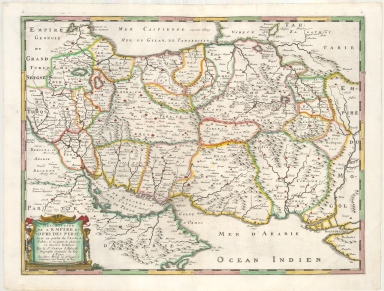
Detail View: Maps: Description De L'Empire du Sophi Des Perses tirée en partie de l'Arabe de Nubie, et en partie de plusieurs et diverses Relations . . .
|
Filename:
|
m20181206-0017.jpg
|
|
Title:
|
Description De L'Empire du Sophi Des Perses tirée en partie de l'Arabe de Nubie, et en partie de plusieurs et diverses Relations . . .
|
|
Coverage:
|
Iran
|
|
Coverage:
|
Caucasus
|
|
Coverage:
|
Asia, Central
|
|
Coverage:
|
Iraq
|
|
Publisher:
|
Paris : Chez Pierre Mariette
|
|
Creator:
|
Sanson, Nicolas, 1600-1667
|
|
Date:
|
1658
|
|
Subject:
|
Early maps
|
|
Description:
|
Detailed map of Iran/Persia and neighboring regions, published by Nicolas Sanson, mapmaker to the King of France. The map shows the region during the reign of the Safavid dynasty (1501-1736).
Appears in Sanson, Nicolas. Cartes generals de toutes les parties du monde...Paris: Chez l'auteur ... et chez Pierre Mariette, 1658.
|
|
Format:
|
1 map : hand colored ; 39 x 52 cm
|
|
Language:
|
French
|
|
Rights:
|
This image may be used without charge for non-commercial web sites under the condition that the sites or pages on which images appear contain a link back to the home page of the Noel Collection. The image may also be reproduced without charge in scholarly publications or in other printed material related to non-profit scholarly activities provided that such publications include a credit line acknowledging the Noel Collection as the source of the visual material. For all other purposes, please request permission to republish or redistribute images from the Noel Collection Curator.
|