Detail View: Maps: Gallia Antiqua in Provincias et Populos divisa
|
Filename:
|
m20181214-0027.jpg
|
|
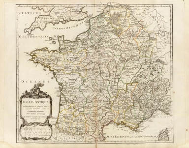
Title:
|
Gallia Antiqua in Provincias et Populos divisa
|
|
Coverage:
|
France
|
|
Creator:
|
Robert de Vaugondy, Gilles, 1688-1766
|
|
Date:
|
1750
|
|
Subject:
|
Early maps
|
|
Description:
|
Gallia Antiqua in Provincias et Populos divisa, Geographicis Sansonum Conatibus et recentioribus Astronomicis Observationibus accommodata, ab Aeg. Robert Geographo regis ordinario. Cum Privilegio Regis. 1750.
The map was published in Atlas Universel, Par M. Robert Geographe ordinaire du Roy, et Par M. Robert De Vaugondy son fils Geographe ord. du Roy, et de S. M. Polonoise, Duc de Lorraine et de Bar, et Associe de L'Academie Royale des Sciences et belles Lettres de Nancy, Avec Privilege Du Roy, 1757. A Paris, Chez Les Auteurs ,Quay de l'Horloge du Palais, Boudet Libraire Imprimeur du Roi, rue St. Jacques. Grave par Ch. Baquoy. J. Oger Scripsit.
|
|
Contributor:
|
Sanson, Nicolas, 1600-1667
|
|
Contributor:
|
Robert de Vaugondy, Didier, 1723-1786
|
|
Language:
|
Latin
|
|
Rights:
|
This image may be used without charge for non-commercial web sites under the condition that the sites or pages on which images appear contain a link back to the home page of the Noel Collection. The image may also be reproduced without charge in scholarly publications or in other printed material related to non-profit scholarly activities provided that such publications include a credit line acknowledging the Noel Collection as the source of the visual material. For all other purposes, please request permission to republish or redistribute images from the Noel Collection Curator.
|