COLLECTION NAME:
Maps
Record
Filename:
m20181214-0025.jpg
Title:
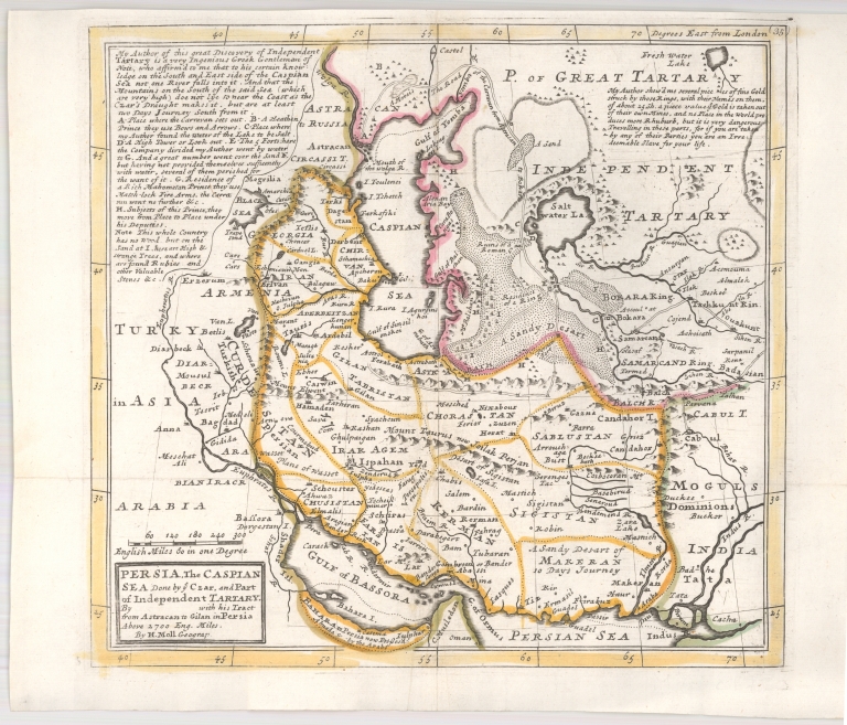
Persia, Caspian Sea
Coverage:
Iran
Coverage:
Central Asia
Coverage:
Caspian Sea
Publisher:
Herman Moll
Creator:
Herman Moll
Date:
1728
Subject:
Regional map
Description:
"Persia, Caspian Sea, done by ye Czar, and Part of Independent Tartary By ... With His Tract from Astracan in Gilan in Persia Above 2700 English MIles"
A map of Persia and the Caspian Sea and adjoining regions, published in London by Herman Moll, based upon Carl Van Verden's landmark mapping of the Caspian.
A map of Persia and the Caspian Sea and adjoining regions, published in London by Herman Moll, based upon Carl Van Verden's landmark mapping of the Caspian.
Format:
9.5 x 10.5 inches
Rights:
This image may be used without charge for non-commercial web sites under the condition that the sites or pages on which images appear contain a link back to the home page of the Noel Collection. The image may also be reproduced without charge in scholarly publications or in other printed material related to non-profit scholarly activities provided that such publications include a credit line acknowledging the Noel Collection as the source of the visual material. For all other purposes, please request permission to republish or redistribute images from the Noel Collection Curator.